


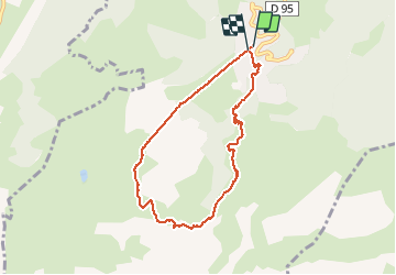

18,1 km | 34 km-effort


Gebruiker


Gratisgps-wandelapplicatie
 SityTrail
IGN / Geografische instituten
SityTrail World
De wereld gaat voor u open
Tocht Stappen van 7,2 km beschikbaar op Auvergne-Rhône-Alpes, Savoie, Les Avanchers-Valmorel. Deze tocht wordt voorgesteld door zazie.
Départ depuis la station Altispace de Valmorel pour une boucle Les Voiles de Nant Les cascades PrarionD et retour Les voiles de Nant.
Mais suite à des travaux à la station Moret, la remontée est impossible. Une autre fois.
Parcours B14 / B15 / B16


Stappen

Ski randonnée

Ski randonnée

Ski randonnée

Ski randonnée

Ski randonnée

Ski randonnée
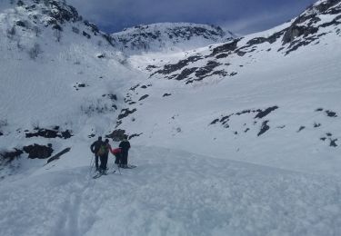
Ski randonnée
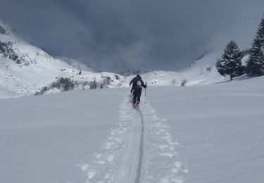
Ski randonnée